
The project
The project was done to study how effective a virtual reality based system would be in enhancing the spatial awareness and related learning in the subject of history for students from rural Indian schools.
The project was done to study how effective a virtual reality based system would be in enhancing the spatial awareness and related learning in the subject of history for students from rural Indian schools.
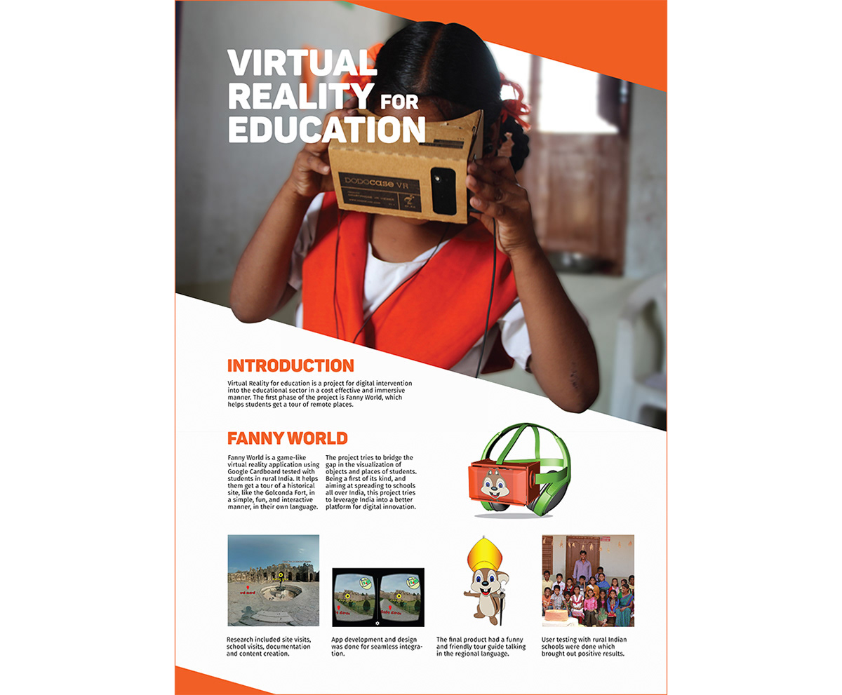
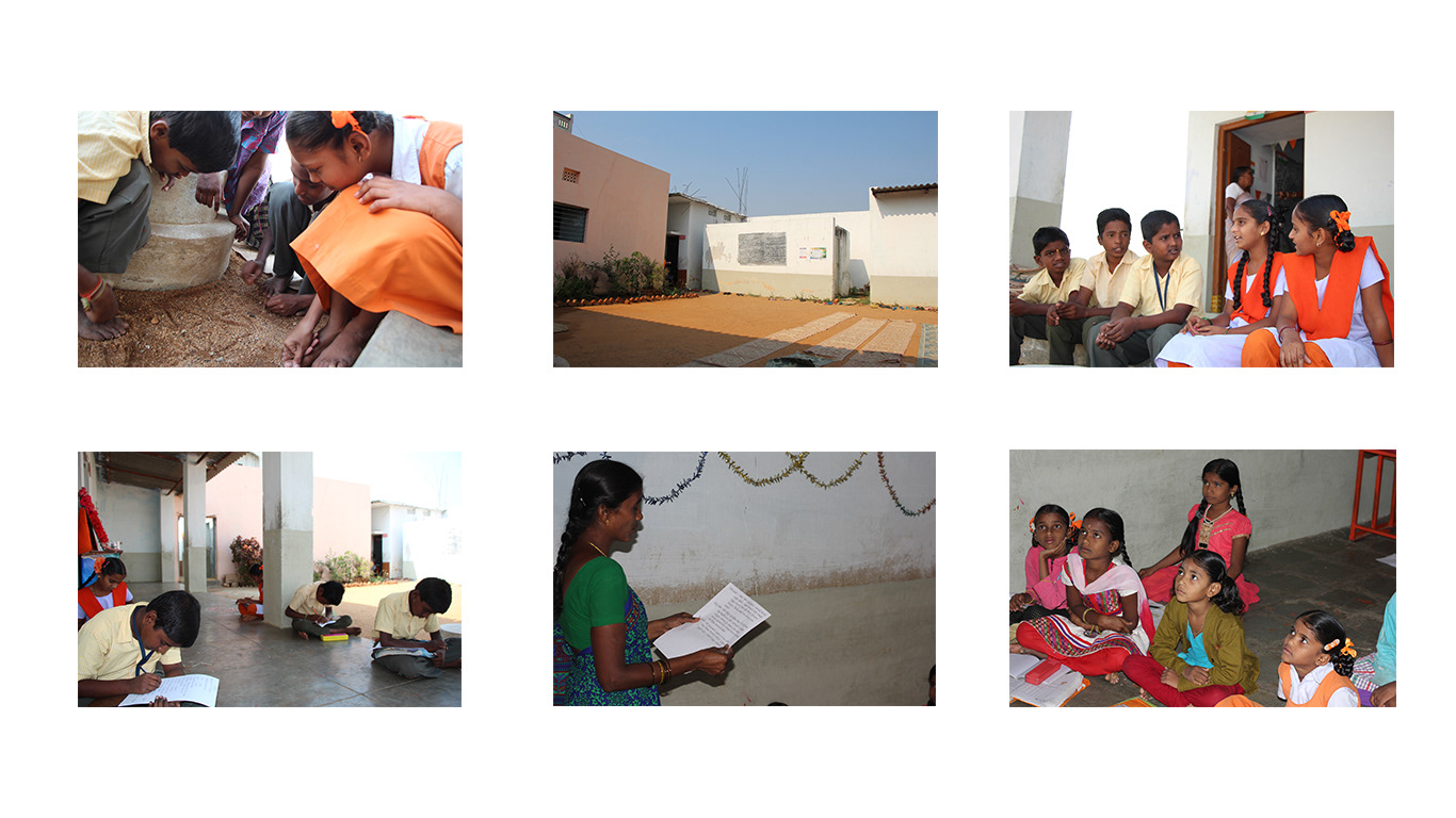
Initial Research
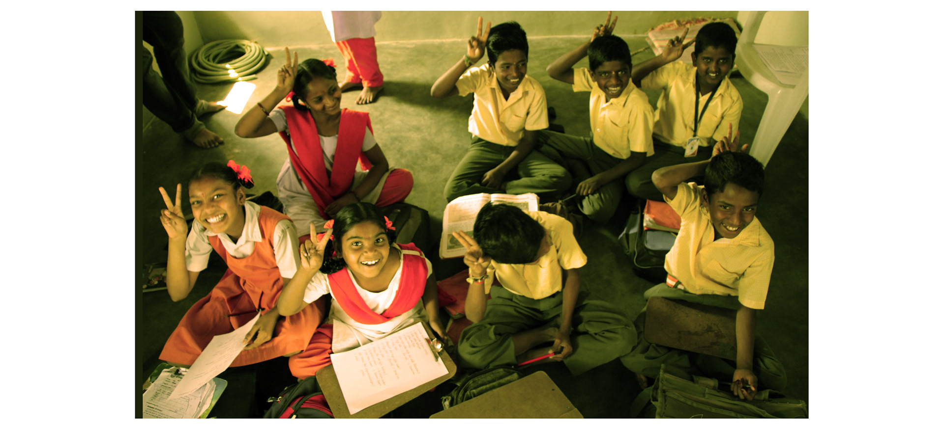
For this project, initial research on the subject was conducted through literature study and interviewing experts in the field of education. It was identified that there is a gap in the present scenario where students were not able to visualize many of the objects or places that were taught in the syllabus.For the project, rural Indian schools were targeted.The students of the schools of Kandi village near IIT was identified for the project due to proximity to the Indian Institute of Technology Hyderabad and considering the ease of travel and access. The syllabus of the students were studied and it was found that there was a portion covering a particular historical site, the Golconda Fort. On interviewing the students, it was found that most of them had not actually been to the historical site. Though the students had English as a subject, they found it easier to read and write in their native language, Telugu. The students from class 3 to 5 were taken as study group since they were familiar with the site and their syllabus covered the same
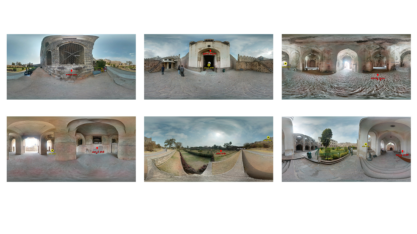
Documentation
The documentation of the site required 360 degree photos to be taken and audio of the tour guide to be recorded. Markers helped identify the main places.
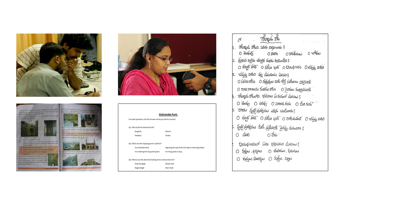
Content Creation
With the help of experts in education, the content was made into a narrative with simple and easily understandable text for the students. The data was then translated into Telugu. The content was recorded as audio in Telugu and was used as voice over for each place of interest in the tour. The pitch of the voice had to be changed to match a hypothetical and popular squirrel voice.) The content was narrated as a story and as a conversation with added elements of humor. From the created content, objective questions were created for the students to answer. These included factual historical questions like “who built the Golconda Fort?”, spatial awareness questions like “how big is the Golconda Fort in relation to your school/Kandi”, error-finding questions like “was there a roof for the place(the place being the answer to a previous question)”. These were again translated into Telugu. Examination questions were also created in Telugu using the same content for analysis.
App design and development
At first the app was planned to be developed as a holistic app with which anyone could make an immersive audio walkthrough with 360 photospheres. For the final app design, a friendly squirrel character, Fanny, was considered as the primary character for the app.The interface was limited to 2 screens to give it a game like feeling. The splash screen and the main screen were designed keeping the historical site in mind and the age of the target group . There were two modes for the app. One was the Virtual reality mode which required the Google Cardboard and one was the normal mode which used only the mobile screen. Upon selecting one of them, the story/module starts. The story would be the 360 view of specific places in the historical site. Markers helped in giving the users a sense of direction. The dynamic map also helped in giving a sense of direction and size. To move from one place to the next, the user had to pull the Google Cardboard trigger. Ambient sounds were added, like birds and wind along-with a background music to help the user to be completely separate from external noise and to be more engaged (the music had a pleasant game tone). Every time the trigger was pulled, an intermediate loading screen was shown which had the text that meant “traveling” instead of “loading”.
At first the app was planned to be developed as a holistic app with which anyone could make an immersive audio walkthrough with 360 photospheres. For the final app design, a friendly squirrel character, Fanny, was considered as the primary character for the app.The interface was limited to 2 screens to give it a game like feeling. The splash screen and the main screen were designed keeping the historical site in mind and the age of the target group . There were two modes for the app. One was the Virtual reality mode which required the Google Cardboard and one was the normal mode which used only the mobile screen. Upon selecting one of them, the story/module starts. The story would be the 360 view of specific places in the historical site. Markers helped in giving the users a sense of direction. The dynamic map also helped in giving a sense of direction and size. To move from one place to the next, the user had to pull the Google Cardboard trigger. Ambient sounds were added, like birds and wind along-with a background music to help the user to be completely separate from external noise and to be more engaged (the music had a pleasant game tone). Every time the trigger was pulled, an intermediate loading screen was shown which had the text that meant “traveling” instead of “loading”.
Initial app iterations
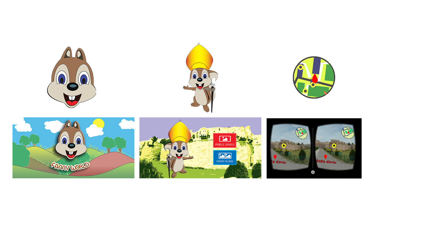
Final app iteration with character design, interface design and dynamic map and other interactive elements.
User testing and future concepts
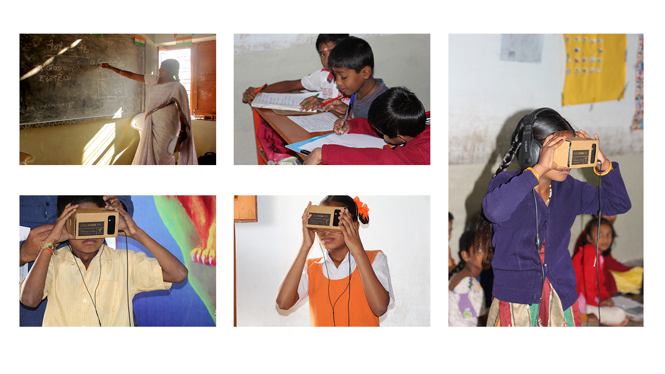
The setup for testing consisted of a Nexus 4 android phone with the Fanny World app installed. This was placed in a Google Cardboard. Headphones were connected for audio. The user testing was done in 3 sets. Separate groups were randomly formed for Virtual Reality based testing and regular teaching method based testing. From the user testing sessions, it was concluded that the spatial awareness of students in relation to a particular historical site can be improved through Virtual Reality when used as an addition to regular teaching methods in rural schools of India. This spatial awareness included facts via observation, colors, and direction.
The setup for testing consisted of a Nexus 4 android phone with the Fanny World app installed. This was placed in a Google Cardboard. Headphones were connected for audio. The user testing was done in 3 sets. Separate groups were randomly formed for Virtual Reality based testing and regular teaching method based testing. From the user testing sessions, it was concluded that the spatial awareness of students in relation to a particular historical site can be improved through Virtual Reality when used as an addition to regular teaching methods in rural schools of India. This spatial awareness included facts via observation, colors, and direction.
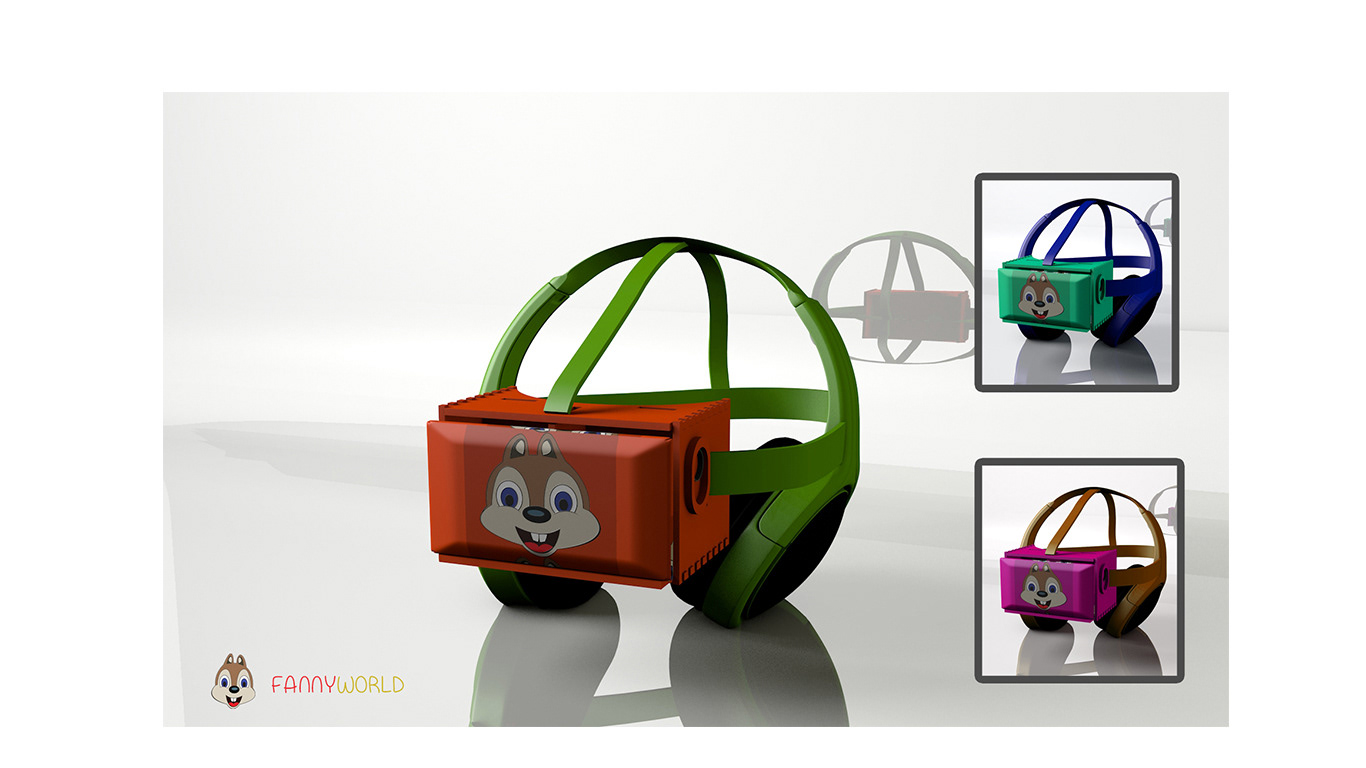
Proposed holistic product design
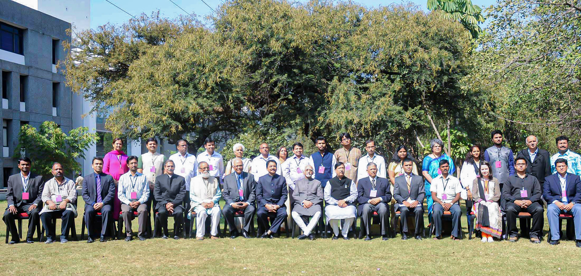
This project was selected as one among the top 20 social innovations from India to be presented at the National Conference on Social Innovation in the presence of the Vice President of India Sri. Hamid Ansari and other dignitaries.
Thank You